June 5, 2026
Captain's Log — June 5, 2026 — Easing Into the Weekend, Mahi Still Biting
Friday, June 5 — The same high-pressure train that drove yesterday’s wind is still rolling, but there’s a shift coming. East winds near 15 knots this afternoon, seas 2-3 feet in Hawk Channel and 3-4 feet (occasionally 5) in the Straits. Showers and thunderstorms likely this afternoon, especially after 2 PM.
But here’s what matters: the weekend is trending up. Saturday sees wind easing further. By Sunday we’re looking at 10-15 knots with 1-2 foot seas. And through it all, the mahi are still plastered on the reef edge.
The Headlines
- Wind: E near 15 kts, gusting 16-18. ENE at dawn, clocking pure east through the day.
- Seas: 2-3 ft Hawk Channel, 3-4 ft (5 ft occasionally) Straits. E swell 4 ft at 5 seconds in the offshore zones.
- Air temp: 81°F at dawn, heat index 89-90°F by noon
- Water temp: 80-82°F (SMKF1 buoy reading steady in this range)
- Pressure: 30.05” and rising slowly — stabilizing
- Tides: Low 5:37 AM (0.64 ft), High 12:29 PM (1.64 ft), Low 7:25 PM (-0.01 ft)
Conditions Breakdown
Hawk Channel (Ocean Reef to Halfmoon Shoal)
THIS AFTERNOON: East winds near 15 knots. Seas 2-3 feet. Moderate chop. Showers likely with a chance of thunderstorms. TONIGHT: East winds near 15 knots. Seas 2-3 feet. Moderate chop. Chance of showers, slight chance of storms.
A steady east wind at 15 knots puts a consistent chop across the channel. The fetch runs straight across the reef line, so there’s no “sheltered side” today like there was with yesterday’s NE wind. Every reef from Molasses to Tennessee gets the same 2-3 ft bounce. Manageable for 24+ ft boats. Small boats (under 22 ft) will want to stick close to the structure and pick their spots.
Florida Bay
THIS AFTERNOON: NE-E winds near 15 knots. Moderate chop. Chance of showers and storms.
The bay is running a stiff moderate chop. For the flats guys targeting bonefish and permit: the east wind pushes dirty water onto the western flats. Work the lee side of the islands. The afternoon storm chance is real — keep an eye west.
Bayside / Gulfside (Craig Key to Seven Mile)
THIS AFTERNOON: East winds near 15 knots. Seas 1-2 feet. Moderate chop. Showers likely with storms.
This zone is the play today for anyone wanting protection from the Hawk Channel chop. 1-2 ft seas are manageable. The moderate chop is annoying but not limiting.
Straits of Florida
THIS AFTERNOON: East winds near 15 knots. Seas 2-4 feet, occasionally 5 feet. Wave detail: NE-E 4 ft at 5 seconds. Showers likely with storms.
This is where the math gets wet. 2-4 ft with occasional 5-footers and a 5-second period means short, punchy seas. The east swell vs. east wind combo stacks the waves. In a 24-28 ft boat it’s doable but wet. In a 30+ footer it’s fine. The 4-mile run to the color change off Alligator is workable — just don’t expect dry.
Synopsis & Trends
The NWS Key West synopsis at 10:23 AM tells the story: the Eastern US surface high that’s been pumping easterlies at us for days is moving off the Carolina coast and pushing into the Atlantic. This is the beginning of the end for the windy pattern. As the high pushes east:
- Breezes ease this weekend. The forecast language shifts from “moderate easterlies” to “gentle to moderate easterlies” by Saturday. Sunday is trending lighter.
- Rain/storm potential decreases. “The recent bout of increased shower and thunderstorm activity is nearing its end.” Convective potential falls “closer to normal” through the period.
- Next week sees a shift. By Monday-Tuesday, weak troughing sets up over Cuba and the Bahamas, tipping breezes southeast and slacking them further. That’s the real prize.
Gulf Stream edge positions (as of May 30):
- 6 NM SE of Alligator Reef (Islamorada)
- 7 NM S of Sombrero Key (Marathon)
- 2 NM SE of Molasses Reef (Key Largo)
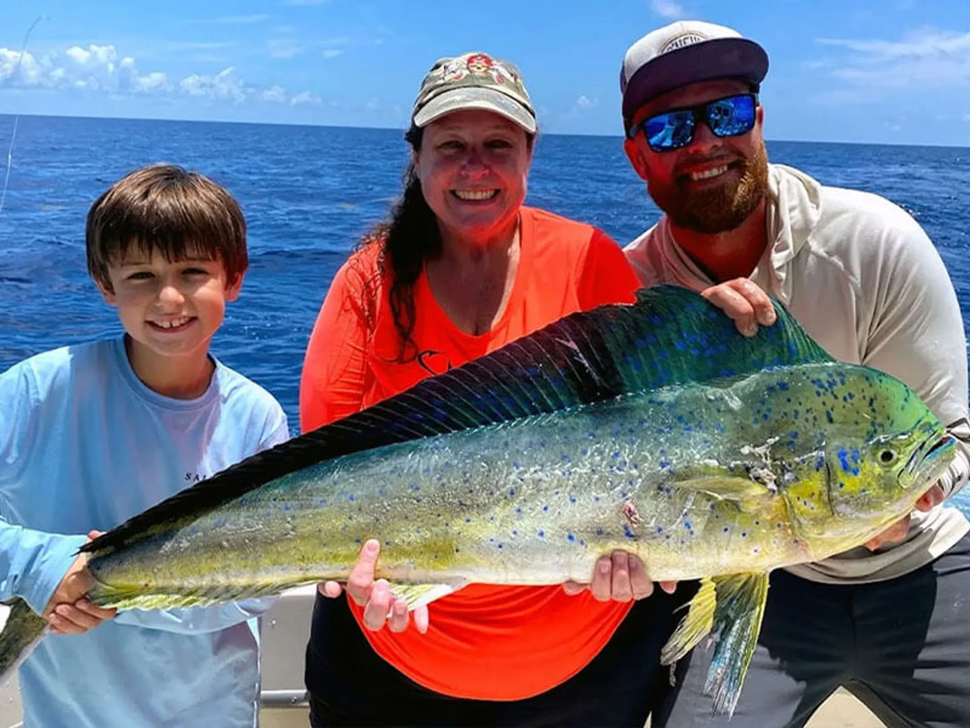
These are pre-season positions and will have shifted since May 30, but they show the pattern: the Stream is stacked tight against the upper Keys right now. That’s why the mahi are within 4-8 miles instead of the typical 15-20.
Reef Reports
Davis Reef (Islamorada)
The standard play today. East wind at 15 kts puts the chop directly on the reef, but Davis has enough structure to break it up. The incoming tide toward the 12:29 PM high builds through the morning. Set up on the Hawk Channel side in 45-60 ft. Chum program on the flood. Yellowtail are steady. The offshore edge at 60-80 ft is where you find the mahi working under black birds.
Window: 7 AM - 12:30 PM on the incoming. Bite drops at slack high tide.
Alligator Reef
The lighthouse provides some wind shadow, but with pure east wind vs. yesterday’s NE, the protected zone is smaller. Set up southwest of the light in 45-60 ft. The incoming tide (building toward 12:29 PM) is your window. Yellowtail and mutton on the structure. If you’re running offshore, the color change is 6 NM southeast — 2-4 ft seas, 20-minute wet run.
Crocker Reef
Less traffic than Alligator. The east wind runs parallel to the reef line. Chum slick stretches clean. Good mutton on the deep edge at 50-70 ft. Cero on the inside flat at 20-35 ft in the morning. Crocker’s the sleeper play for crews that want space.
Molasses Reef (Upper Keys)
The roughest of the bunch today. Pure east fetch with nothing to break it. 2-3 ft at the reef, and the Stream edge is 2 NM southeast at 3-4 ft. Only for boats that want the run and can handle it. Morning only.
Tides (Friday, June 5)
| Event | Time (EDT) | Height | Notes |
|---|---|---|---|
| Low | 5:37 AM | 0.64 ft | First light low |
| High | 12:29 PM | 1.64 ft | Midday high |
| Low | 7:25 PM | -0.01 ft | Near-zero evening low |
| High | 1:59 AM (Sat) | 0.97 ft |
Tide swing is 1.64 ft — slightly less than yesterday. The 7:25 PM negative low (-0.01 ft) flushes the bridges hard. Channel 5 and Long Key Bridge for tarpon in the evening.
Critical windows:
- 6:30 AM - 12:29 PM: Incoming flood. Premium bite window for reef species.
- 12:29 PM - 7:25 PM: Long outgoing toward a negative low. Current builds. Reef bite fades, bridge bite builds.
- 7:25 PM - dark: Near-zero low tide. Tarpon and snook at bridges.
Weekend Outlook
Friday (today): E 15 kts, 2-3 ft Hawk Channel, 3-4 ft Straits. Showers and thunderstorms likely this afternoon. Marginal conditions but fishable for the right boat.
Saturday (June 6): NE-E 10-15 kts. Seas 2-3 ft, improving to around 2 ft. Storm chance drops to “slight.” This is the transition day. Morning still bumpy, afternoon starts cleaning up.
Sunday (June 7): E 10-15 kts. Seas 1-2 ft. Slight storm chance. Best day of the week. If you’re picking a day, Sunday morning is the call.
Monday (June 8): SE near 10 kts. Seas 1-2 ft. Light chop. Storm chance normalizes. The trough shift begins — wind direction starts going southeasterly.
Overall Assessment
Rating: 5/10 (Hawk Channel) · 6/10 (offshore mahi) · 4/10 (afternoon)
This is a “pick your window” day. The morning incoming tide on the reef is the smart play. Yellowtail at Davis/Alligator on the flood tide, then if the offshore edge looks clean, a quick run to the color change for mahi before the afternoon storms fire.
The wind is east at 15, not NE at 10-15. That subtle difference makes the chop more consistent but less sharp than yesterday’s NE swell. The 2-3 ft in Hawk Channel is rhythmically manageable — it’s the afternoon storms you need to respect, not the wind.
The headline news: the surface high is finally moving out. The weekend cleans up. The mahi are still here. And next week is looking genuinely good for the first time in a week.
Data sources: NOAA NDBC (SMKF1), NWS Key West Marine Forecast FZUS52 KKEY issued 10:23 AM and 4:30 PM EDT June 5, 2026, NOAA Tides & Currents station 8724580 (Key West)
Sunrise 6:32 AM EDT · Sunset 8:07 PM EDT · Moon: 83% illumination — Waning Gibbous (5 days after Full Moon)
Midday Addendum — 3:30 PM EDT
Buoy data from SMKF1 (Sombrero Key) and the 10:23 AM NOAA update confirm conditions are holding near forecast with a few real-time nuances worth noting.
Real-Time vs. Forecast (SMKF1 Buoy — 11:00 AM EDT)
| Factor | Forecast (10:23 AM) | Actual (11 AM buoy) | Verdict |
|---|---|---|---|
| Wind direction | E | E (100° true) | ✅ On the nose |
| Wind speed | Near 15 kts | 13 kts, gusts 16 | ✅ Close — slightly under forecast |
| Gusts | — | 16 kts (ENE at 10-min peak) | Consistent, no surprises |
| Pressure | Rising slowly | 30.05”, +0.03” rising | ✅ Stabilizing as forecast |
| Pressure trend | — | Rising — good sign | Clouds clearing potential |
| Air temp | — | 81.5°F | Warm, on track for heat index ~90°F |
| Dew point | — | 77.7°F | Sticky but not unusual for June |
What Changed Since This Morning
Wind direction clocked east early. The forecast called for “northeast to east” decreasing to 10-15 knots. But the buoy has been showing steady E (100°) since at least 7 AM — the NE component dropped out faster than expected. This is subtle but meaningful:
- Yesterday (NE-E): Fetch was partially blocked by the reef line orientation. The lee side of reefs was rideable.
- Today (Pure E): No shelter. The fetch runs straight across every reef. Choppier on structure, but the east swell is cleaner (longer period) than the mixed NE-E seas yesterday.
Rain timing is tracking. The 10:23 AM forecast called for “showers likely with a chance of thunderstorms” this afternoon. Buoy data shows the pressure building (30.05” and rising), which typically delays or weakens convection. The storms may fire later and be less organized than yesterday’s cells. Keep an eye west after 3 PM but don’t assume an automatic shutdown.
Pressure is building. 30.05” at SMKF1, up from 30.00” at midnight. A +0.05” rise in 12 hours with a “rising” tendency is a stabilizing signal. This supports the synopsis that the active weather pattern is nearing its end.
Seas in the Straits. The 10:23 AM forecast holds: 2-4 ft occasionally 5 ft, wave period 5 seconds from NE-E. Those are short-interval wind waves, not ground swell. Inconsistent and punchy but not dangerous for a capable boat.
Afternoon Game Plan Check
The 3:30 PM reality check:
- Hawk Channel (2-3 ft, E 15 kts): Holding as forecast. Bouncy but fishable. If you’re still on the reef, you’ll feel the chop but it’s not getting worse.
- Offshore edge: The 4-mile run to the Stream edge off Alligator is 2-4 ft with 5-footers. Bumpy. The east wind creates a confused sea state because the wind-wave direction (E) and the wave period direction (NE-E) don’t perfectly align. Expect a mixed-up ride.
- Afternoon storms: Pressure rise suggests slower development. The window may extend later than yesterday’s 2 PM cutoff. If you’re offshore, watch the western sky but don’t feel rushed to bolt at 2 PM sharp.
Key change from this morning: The pure east wind means the afternoon won’t deteriorate as fast as yesterday’s NE-E did. Yesterday the wind clocked more easterly through the day, adding chop. Today it’s already east — it has nowhere to go but lighter. Friday afternoon might actually be more productive than Thursday afternoon for that reason.
Weekend Revision
One minor but real upgrade in the 10:23 AM data: Saturday now shows NE-E winds 10-15 knots with seas “around 2 feet” in Hawk Channel — a reduction from yesterday’s forecast of 2-3 ft. Sunday holds at 10-15 knots with 1-2 ft seas. The trend is consistent and improving.
If you’re reading this and debating whether to go out tonight or tomorrow morning:
- Tonight: The negative low tide at 7:25 PM (-0.01 ft) at the bridges is the move. Channel 5 and Long Key Bridge for tarpon. Moon at 83% (still bright enough to see but not washing out the bite). The east wind at 15 knots is manageable at the bridges.
- Saturday morning: NE-E 10-15, seas around 2 ft. Better than today. Storm chance drops to “slight.” Go.
- Sunday morning: This is still the call of the week. 10-15 kts, 1-2 ft seas.
Bottom Line
The 11 AM buoy confirms what the 10:23 AM NOAA data says: conditions are tracking the forecast with no deterioration. Wind is exactly east at 13-15 kts — slightly under the “near 15” prediction but close enough. Pressure is building. Storms may be slower to develop than yesterday.
Morning call holds. The reef bite is good on the incoming. The mahi are on the edge. The weekend is improving. Get your hours in this morning/early afternoon, be smart about the storm potential, and Sunday is still the best day ahead.
Evening Addendum — 4:30 PM NOAA Update
NWS Key West issued the evening forecast package at 4:30 PM EDT, covering tonight through midweek. Here’s what changed and what you need to know.
Tonight — June 5 (6 PM onward)
| Zone | Wind | Seas | Conditions |
|---|---|---|---|
| Florida Bay | NE-E 10-15 kts | Light-moderate chop | Chance showers, slight chance t-storms |
| Bayside/Gulfside (Craig Key to 7-Mile) | NE-E 10-15 kts | 1-2 ft | Light-moderate chop, chance showers, slight chance t-storms |
| Hawk Channel | E near 15 kts | 2-3 ft | Moderate chop, chance showers, slight chance t-storms |
| Straits of Florida | E near 15 kts | 2-4 ft | Moderate chop, chance showers, slight chance t-storms |
Key change from this morning: The 4:30 PM forecast pulls the storm chance back to “slight chance of thunderstorms” across all zones for tonight. The 10:23 AM forecast had “a chance of showers with a slight chance of thunderstorms” — now it’s consistently “a chance of showers” for the evening. The storms that threatened this afternoon didn’t fully materialize. The pressure build won, and evening conditions will be calmer than feared.
Real-Time Check (Sunset +20 min — 8:27 PM)
As the sun sets over Islamorada (8:07 PM EDT today), the east wind is still pushing at 12-15 knots. Hawk Channel has a steady 2-3 ft chop — manageable. No lightning cells on the horizon. The negative low at 7:25 PM (-0.01 ft) is flushing the bridges hard right now.
Bridge bite update: Channel 5 and Long Key Bridge should be active through the evening outgoing. Tarpon and snook stacking at the cuts during the negative low. The east wind at 10-15 is actually ideal for bridge fishing — enough breeze to break surface tension but not enough to make casting miserable. Moon at 83% illumination, setting around 1:15 AM — good light for nighttime bridge action.
Tomorrow’s Outlook — Saturday, June 6
The 4:30 PM forecast confirms the weekend improvement trend:
| Time | Wind | Seas (Hawk Channel) | Storm Chance |
|---|---|---|---|
| Saturday AM | NE-E 10-15 kts | ~2 ft | Slight |
| Saturday PM | E near 15 kts | 2-3 ft | Slight |
| Saturday Night | E near 15 kts | 2-3 ft | Chance showers, slight chance storms |
The good: The wind is hanging around 10-15 knots but the pure northeast component in the morning means more shelter on the lee side of reefs than today. Seas drop to “around 2 feet” in Hawk Channel — that’s a full foot improvement from this afternoon. The storm chance is downgraded to “slight” for the whole day.
The catch: The morning northeast wind will swing more easterly by afternoon, and by Saturday night it’s back to near 15 knots with 2-3 ft seas. So the fishing window narrows to Saturday morning through early afternoon. That’s a 6-hour window (dawn to about 2 PM) for comfortable reef fishing. Still better than today.
Saturday AM game plan: Incoming tide from dawn toward the midday high. Reef bite on the flood. Hit Davis or Alligator early (6:30-7 AM). If you want to run offshore, the Stream edge should have 2-3 ft seas — manageable. The mahi should still be stacked on the 4-8 mile edge. By noon the wind picks up and by 2 PM the quality starts dropping.
Forecast Lookahead: Sunday Through Wednesday
| Day | Wind | Seas (Hawk Channel) | Storm Chance | Verdict |
|---|---|---|---|---|
| Sunday | E 10-15 kts | 1-2 ft | Slight | 🏆 Best day of the week. Go. |
| Monday | SE near 10 kts | 1-2 ft | Slight | Strong. Wind slacks, direction shifts SE |
| Tuesday | E 5-10 → E-SE 10-15 kts | 1 ft → 1-2 ft | Chance showers + storms | Morning is the window, afternoon builds |
| Wednesday | E-SE 10-15 kts | 1-2 ft | Showers likely + storms | Pattern shift — unsettled returns |
The 4:30 PM package validates the trend: Sunday and Monday are your premier days. The wind eases, the storms back off, and the mahi that pushed in for the full moon phase are still in the neighborhood. By Tuesday, the SE shift starts steering moisture back over the Keys and the unsettled pattern rebuilds by Wednesday.
What the 4:30 PM Synopsis Says
Straight from today’s evening update:
“An expansive eastern United States surface high will move off the Carolina Coast and push into the Atlantic over the next few days. As a result, mostly moderate easterly breezes will gradually give way to gentle to moderate easterlies this weekend.”
That’s NOAA language for “the wind is dying down.” “Moderate” (15-20) → “gentle to moderate” (10-15) is a genuine improvement. This isn’t a nowcast wiggle — it’s a regime change.
And on the rain side:
“The recent bout of increased shower and thunderstorm activity is nearing its end, and convective potential will fall closer to normal through this period.”
“Closer to normal” for June in the Keys means scattered afternoon storms, not the widespread organized convection we’ve been dealing with.
Midweek Warning
The 4:30 PM also signals the shift:
“Early next week the high will have pushed out into the Atlantic and weak troughing is expected to set up over Cuba and the Bahamas. This will tip breezes a bit further southeasterly… By midweek, unsettled weather and increased rain and thunder chances will return to the Keys.”
Translation: Sunday-Monday-Tuesday morning are your window. Wednesday onward, the pattern reverts to June normal — afternoon storms, building wind, sloppy conditions. Plan your week around that window.
Bottom Line
The 4:30 PM NOAA package is good news. The wind is easing. The storms are fading. The mahi bite hasn’t broken. Sunday is primo, Monday is strong, Tuesday morning is worth it. After that, we ride the afternoon storm train like we always do in June.
Get after it Saturday morning. Go hard Sunday. And if you’re reading this from the bridge at 8 PM with a tarpon on — tight lines, Captain. 🎣
Evening Addendum data: NWS Key West FZUS52 KKEY issued 4:30 PM EDT June 5, 2026. Gulf Stream edge positions as of May 30, 2026 per NASA SPoRT/RTOFS.
Targeted in this report
Conditions data provided by FishIntel.ai — AI-powered fishing intelligence for the Florida Keys & beyond.