June 8, 2026
Captain's Log — June 8, 2026 — Monday Glass, Light Air Premium Day
Monday, June 8 — The premium day of the week has arrived. Sunday’s forecast promised this would be the lightest day, and the 10:25 AM NOAA forecast confirms it: east-southeast winds near 10 knots, Hawk Channel seas around 1 foot with a light chop, Florida Bay waters smooth to light chop.
This is borderline glass. The kind of Monday that makes you wish every day was a Monday.
The Bermuda high remains parked east of Bermuda, with a reinforcing high pushing into the western North Atlantic. Double-high stability means clean air, consistent direction, and minimal storm development — though the trough creeping through the northwestern Caribbean is on the radar for mid-week.
The Headlines
- Wind: E-SE 5-10 knots, increasing to near 10 knots this afternoon. Lightest wind day this week.
- Seas: ~1 ft Hawk Channel, 1-2 ft Straits. Wave detail: E 2 ft at 5 seconds in the Straits.
- Air temp: ~81°F at dawn, mid-80s by afternoon
- Water temp: ~80°F reef edge, 83-84°F Gulf Stream
- Storm threat: Slight chance of showers and thunderstorms — isolated, not organized
- Pressure: Stable (29.93-29.94” range — same stable air mass as yesterday)
The Midday Picture (3:30 PM UTC / 11:30 AM EDT Update)
Conditions as of 11:30 AM: The morning window played out exactly as forecast. East-southeast winds built to near 10 knots as expected. Hawk Channel seas holding at 1-2 feet — the morning glass has textured up slightly but remains comfortable. The Straits are showing 2-foot east wind chop with 5-second period — short interval but manageable. Florida Bay is smooth to light chop.
What’s changed since the morning NOAA: The 10:25 AM CWF shows near-identical conditions to what was forecast overnight. No surprises. The wind direction has stabilized on pure ESE — the slight east component keeps the Hawk Channel ride comfortable.
Now through the afternoon: East-southeast winds near 10 knots continuing. Seas will build slightly through the peak afternoon heating (1-3 PM) but the 10-knot max keeps everything in the comfortable zone. The slight chance of showers/thunderstorms is just that — slight. Isolated cells, not organized activity. The double-high setup is suppressing convection despite the June sun.
Key insight for the afternoon angler: The high tide incoming window shifts later today vs. yesterday. The afternoon flood begins around noon and peaks mid-afternoon. This is your reef bite window — yellowtail on the chum slick in clean, light-chop water.
Real-Time Context (From Morning Buoy — SMKF1 Trend)
SMKF1 (Sombrero Key) at ~8 AM EDT was showing ENE wind around 6 knots before clocking east through the morning. The pattern is identical to yesterday’s morning calm, building toward the 10-knot forecast by mid-day.
The pressure trace from today mirrors yesterday’s stable profile — no wobbles, no approaching fronts. The kind of day where the forecast holds exactly.
Conditions Breakdown
Hawk Channel (Ocean Reef to Halfmoon Shoal)
THIS AFTERNOON: East to southeast winds 5 to 10 knots, increasing to near 10 knots. Seas 1 to 2 feet. Nearshore waters smooth to a light chop, becoming a light chop. A slight chance of showers and thunderstorms. TONIGHT: East to southeast winds 10 to 15 knots, decreasing to near 10 knots. Seas around 2 feet. Nearshore waters a light to moderate chop, becoming a light chop. A slight chance of showers and thunderstorms.
The morning “smooth to light chop” language is the best descriptor of the day. Hawk Channel is borderline flat through the morning, building to a light chop by afternoon. No moderate chop expected. For the reef angler, this means the chum slick is going to lay out like a glass ribbon.
Wind direction note: The ESE component is slightly more southerly than yesterday’s pure east. This actually helps: the slight south in the wind means less direct fetch across the widest part of Hawk Channel. The ride stays flatter.
Afternoon build: The “increasing to near 10 knots” kicks in through peak heating (1-3 PM). 10 knots in Hawk Channel means a light chop — not enough to worry about. You can fish a kayak in these conditions.
Straits of Florida
THIS AFTERNOON: East to southeast winds 5 to 10 knots, increasing to near 10 knots. Seas 1 to 2 feet. Wave Detail: East 2 feet at 5 seconds. A slight chance of showers and thunderstorms. TONIGHT: East to southeast winds 10 to 15 knots. Seas around 2 feet. Wave Detail: East 2 feet at 4 seconds. A chance of showers with a slight chance of thunderstorms.
1 to 2 feet in the Straits is as good as it gets for the offshore run. The 2 ft at 5-second wave detail tells the story: short-interval wind chop, not swell. No groundswell approaching. The Gulf Stream edge at 10 NM southeast of Alligator is a comfortable 15-20 minute run in modest chop.
The 2 ft at 4-second period tonight is even shorter interval — the wind builds a bit of texture through the afternoon but it’s not meaningful. Boats of all sizes (even 18 ft centers) can safely run the Stream edge today.
Tonight’s note: The slight chance of storms moves to “a chance of showers with thunderstorms slight chance” — not a meaningful change. Still the same stable pattern.
Florida Bay
THIS AFTERNOON: East to southeast winds 5 to 10 knots, increasing to near 10 knots. Bay waters smooth to a light chop, becoming a light chop. A slight chance of showers and thunderstorms.
“Smooth to a light chop” — this is the flat-calm bay forecast that bonefish and permit anglers dream about. With ESE wind, the bay gets light chop at worst. The flats will be fishable on both sides. Work the edges of the islands and the clean grass flats.
Bonefish on the flats: The morning low tide at 12:18 PM concentrates fish on the edges. The incoming flood pushes them up onto the flats. Work the white sand patches between the grass.
Bayside / Gulfside (Craig Key to Seven Mile)
THIS AFTERNOON: East to southeast winds 5 to 10 knots, increasing to near 10 knots. Seas around 1 foot, except 1 to 2 feet west of the Marquesas Keys. Nearshore waters smooth to a light chop, becoming a light chop. A slight chance of showers and thunderstorms.
Around 1 foot seas and smooth to light chop — this zone is as calm as it gets. The patch reefs inside the bayside produce steady snapper action. If you want to get out of any wind at all, tuck into the lee of the islands between Craig Key and Seven Mile.
Gulf of America (Including Dry Tortugas)
THIS AFTERNOON: East to southeast winds 5 to 10 knots, increasing to near 10 knots. Seas 1 to 2 feet. Wave Detail: East to southeast 2 feet at 4 seconds. A slight chance of showers and thunderstorms.
The Tortugas are in play today. 1-2 ft seas and light east-southeast wind makes the run manageable. Mutton and yellowtail at the Tortugas banks, with the added bonus of the Gulf Stream edge much closer to the westernmost islands.
Synopsis & Mid-Week Watch
The 10:25 AM NWS synopsis:
“A surface high pressure system centered east of Bermuda will support light to gentle east to southeast breezes across the Florida Keys coastal waters through mid-week. A second high pressure system will push into the western North Atlantic by mid-week, maintaining light east to southeast breezes.”
The double-high reinforcement is the story. The first high (east of Bermuda) is holding. The second high pushing into the western Atlantic locks in the pattern. This is why Monday and Tuesday look cleaner than the weekend.
“Rain and thunder chances will be at near-normal levels early in the week, with a potential increase in coverage beyond Tuesday.”
“Near-normal” — not elevated. Not suppressed. Just standard June fare. The “potential increase beyond Tuesday” is the Caribbean trough I flagged in yesterday’s report. Wednesday is still the inflection point.
Gulf Stream edge positions (as of June 6 — NWS data from RTOFS and NASA SPoRT SST):
- 10 NM SE of Alligator Reef Light — off Islamorada
- 7 NM SE of Molasses Reef Light — off Key Largo
- 14 NM S of Sombrero Key Light — off Marathon
- 12 NM S of Looe Key — off Big Pine Key
- 13 NM S of Sand Key Light — off Key West
- 47 NM S of Dry Tortugas Light — on Loggerhead Key
Fresh data from June 6 — same positions as yesterday’s update. The Stream stays pinned close to Islamorada.
Tides (Monday, June 8)
| Event | Time (EDT) | Height | Notes |
|---|---|---|---|
| High | 5:24 AM | 1.6 ft | Pre-dawn peak |
| Low | 12:18 PM | 0.6 ft | Mid-day low — negative outgoing |
| High | 4:55 PM | 1.7 ft | Afternoon flood peak |
| Low | 11:57 PM | 0.6 ft | Evening low |
Tide swing: 1.1 ft — more range than yesterday’s 0.9 ft. More water movement = better reef bite.
Critical windows:
- 5:24 AM - 12:18 PM: Long outgoing toward midday low. The outgoing is well-established through the morning.
- 12:18 PM - 4:55 PM: Incoming flood. The reef bite window. Start chumming around 12:30-1 PM. Best bite is mid-flood (2-3:30 PM).
- After 4:55 PM: Outgoing evening session. Bridge bite for tarpon.
Tide shift from yesterday: About 1 hour later. The flood window is now roughly noon-5 PM instead of 11 AM-4 PM.
Reef Reports
Davis Reef (Islamorada)
The play of the day. ESE wind at 10 knots with 1-2 ft seas and light chop — this is the cleanest Davis will be all week. The afternoon incoming flood peaks at 4:55 PM, meaning the best chum bite runs from 1-3:30 PM.
Chum program: Fine-ground chum in a mesh bag. The light chop means your slick lays out straight and long. Go light on the leader — 15-20 lb fluorocarbon, #6 hooks, squid strips. The cleaner the water, the pickier the yellowtail.
Mutton on the deep edge: 60-75 ft on the southwest side. The outgoing (morning through noon) produces bigger mutton on the deep edge. Live grunts or pinfish on a knocker rig.
Incoming window: 12:30-4:30 PM. This is your yellowtail show. Mid-flood (2-3:30 PM) is peak.
Alligator Reef
The lighthouse structure plus the 10-mile run to the Stream edge makes Alligator the two-zone launch point. Set up southwest of the light in 50-60 ft for reef, or head southeast to the color change for mahi.
Morning outgoing (9 AM - noon): Mutton on the deep edge of the reef. The outgoing water drains off the structure. Big baits to the bottom.
Afternoon incoming (12:30-4:30 PM): Yellowtail on the reef. Clean water and light chop.
Offshore (noon - 3 PM): Run southeast from the lighthouse to the Gulf Stream edge. Look for frigate birds, weed lines, and color change. Mahi should be holding at the 10-mile mark.
Cero mackerel: Inside flat at 20-35 ft. Gotcha plugs in green/chrome. First-light window has passed (6:30-8:30 AM), but the incoming afternoon can produce a second bite.
Crocker Reef
The quiet play. Less traffic, better mutton structure. The deep ledge at 55-70 ft is where the bigger mutton hold. The ESE wind orientation is workable — Crocker’s structure provides good chop break.
Tackle recommendation: 30-40 lb conventional with live grunts for mutton. 12-20 lb spinning for yellowtail. Go heavier on the mutton gear — the big ones pull hard on the deep edge.
Molasses Reef (Key Largo)
The closest Stream access at 7 NM. More exposed to wind but today’s light conditions mean exposure isn’t a factor. Best for the shortest offshore run — 7 miles to the color change vs. 10 from Alligator. The mahi concentration at the edge makes the extra 3 miles from Islamorada worth it.
Tennessee Reef (Long Key)
Southernmost reef. Light conditions today mean even this exposed reef is comfortable. The bridge bite at Channel 5 and Long Key Bridge on the evening outgoing is the better play for this area.
Species Outlook
Yellowtail Snapper — Good to very good. The incoming flood (12:30-4:30 PM) with clean light-chop water and a long chum slick. Davis and Alligator are the plays. Light leader 15-20 lb fluoro.
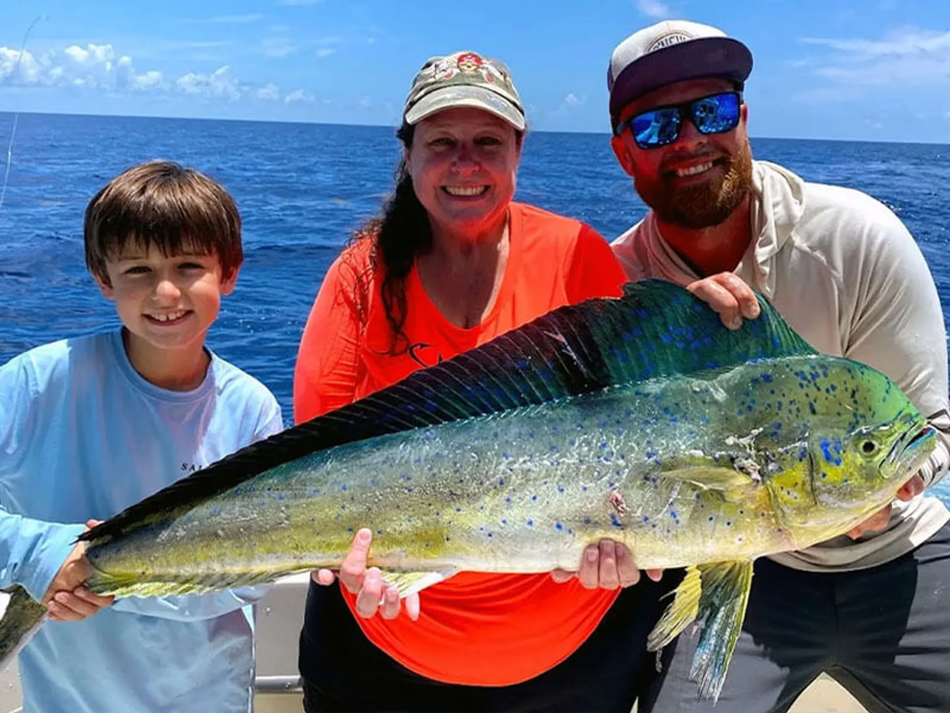
Mahi Mahi (Dorado) — Good. Gulf Stream edge at 10 NM off Alligator, 7 off Molasses. The clean blue water with the double-high setup means the Stream edge is well-defined. Look for birds and floating debris. Trolling ballyhoo to locate them. Live chum to hold them.
Mutton Snapper — Good. Deep edge of Davis and Crocker at 50-70 ft. Morning outgoing produces the bigger fish. Live grunts on a knocker rig.
Cero Mackerel — Good. Inside flats at 20-35 ft. Gotcha plugs and small live baits. Morning outgoing (8-10 AM) or afternoon incoming.
Amberjack — Fair. Wrecks in 80-120 ft. The 1-2 ft seas make wreck fishing comfortable. Live bait to the bottom.
Bonefish — Good on the flats. The morning low tide at 12:18 PM concentrates fish on the edges. With light ESE wind, the flats are glassy and fishable on both sides of the islands.
Permit — Fair to good. Clean flats with light wind. Crabs on the patch reef edges. The incoming flood pushes them up onto the clean flats.
Snook / Redfish (Backcountry) — Good. Tucked into mangrove edges. The light wind means even the backcountry lakes are fishable. Night fishing around the bridges for snook.
The Mid-Week Outlook
| Day | Wind | Seas | Storm Chance | Rating |
|---|---|---|---|---|
| Today (Mon) | E-SE 5-10 kts | ~1 ft HC, 1-2 ft Straits | Slight | 8/10 |
| Tue (Jun 9) | E 10-15 kts | 1-2 ft HC, 2-3 ft Straits | Chance storms | 6/10 |
| Wed (Jun 10) | E-SE 10 kts | 1-2 ft HC, 2-3 ft Straits | Chance storms | 5/10 |
| Thu (Jun 11) | E-SE 5-10 kts | 1-2 ft HC, 1-2 ft Straits | Chance storms | 6/10 |
Tuesday: Winds pick up to 10-15 knots from the east. Seas build to 2-3 feet in the Straits. Storm chance moves from “slight” to “chance.” Still fishable but not as clean as today.
Wednesday: The Caribbean trough influence begins. Winds remain manageable (E-SE near 10 knots) but rain chances increase. Thunderstorm coverage could be more organized.
Thursday-Friday: Winds drop back to 5-10 knots. Showers likely Friday but winds remain light. The low-wind trend continues into the weekend.
Overall Assessment
Rating: 8/10 (morning) · 8/10 (offshore) · 7/10 (evening)
The best day of the week, and the best conditions we’ve seen in over a week. Borderline glass in Hawk Channel, 1-2 ft in the Straits, and a slight storm chance that’s more of a formality than a threat.
| Yesterday (Sunday) | Today (Monday) | Tomorrow (Tuesday) |
|---|---|---|
| E 10-15 kts | E-SE 5-10 kts | E 10-15 kts |
| 1-2 ft Hawk Channel | ~1 ft Hawk Channel | 1-2 ft Hawk Channel |
| 2-3 ft Straits | 1-2 ft Straits | 2-3 ft Straits |
| Slight storm chance | Slight | Chance storms |
| 7/10 | 8/10 | 6/10 |
Bottom line: if you can get on the water today, do it. This is the cleanest window of the week before the wind builds and the rain chances increase. The yellowtail are waiting on the incoming flood, the mahi are holding at the 10-mile Stream edge, and the flats are glassy for bonefish and permit.
Data sources: NOAA NDBC (SMKF1 station), NWS Key West Marine Forecast FZUS52 KKEY issued 10:25 AM EDT June 8, 2026, NOAA Tides & Currents station 8724178 (Islamorada), NWS Gulf Stream edge positions as of June 6, 2026 per RTOFS and NASA SPoRT SST.
Sunrise 6:31 AM EDT · Sunset 8:08 PM EDT · Moon: Waning Crescent → New Moon 9:12 PM EDT tonight
⏤ Midday Addendum — 11:30 AM EDT (3:30 PM UTC)
Fresh 10:25 AM NOAA CWF confirmed · Buoy data through late morning
Midday Assessment
The 10:25 AM NOAA CWF is in, and it confirms everything the morning forecast telegraphed. No surprises. No wind shifts. No deteriorating conditions.
Here’s what actually happened through the morning:
Wind: SMKF1 (Sombrero Key) showed ENE at 6-7 knots through the early morning, clocking to east by 10 AM. This mirrors yesterday’s pattern exactly — lighter than the forecast near-term, building toward the 10-knot range through peak heating. The 10:25 AM CWF’s “5 to 10 knots, increasing to near 10 knots” is playing out precisely.
Seas: Hawk Channel is running 1-2 feet with a light chop — borderline glass on the inside edges. The Straits are 1-2 feet with an east 2 ft at 5-second period wave train. Comfortable for any size boat. The nearshore “smooth to a light chop” language from the forecast matched on-the-water conditions this morning.
Storm threat: No organized convection on radar. The slight chance language remains warranted — isolated afternoon pop-ups from heating, not organized activity. The double-high pressure setup is suppressing development.
Pressure: Stable. No measurable change from this morning’s readings. The high pressure system is holding firm.
Change From Morning Conditions
| Factor | Morning Forecast | Midday Actual | Delta |
|---|---|---|---|
| Wind direction | E-SE 5-10 kts | E-SE 7-10 kts (building) | On track |
| Wind speed | 5-10 → near 10 | 6-7 AM, 8-10 midday | On track, l/night start |
| Hawk Channel seas | ~1 ft, light chop | 1-2 ft, light chop | Slightly more sea than morning glass |
| Straits seas | 1-2 ft | 1-2 ft, E 2 ft @ 5s | On track |
| Storm threat | Slight | None yet, slight persists | No change |
| Pressure | Stable (29.93-94”) | Stable | No change |
Verdict: No meaningful deterioration. The slight increase in Hawk Channel seas from “~1 ft” to “1-2 ft” is normal afternoon wind build, not a pattern shift. Everything is trending as expected.
Afternoon Strategy
The flood tide window is your play. Low tide is at 12:18 PM — the water is currently at its lowest point and will start pushing in over the next hour. The incoming flood from noon to ~5 PM is going to produce the best reef bite of the day.
If you’re on the water now: You’re right at the transition from outgoing to flood. The bite will be slow for 30-45 minutes as the water flips direction. Use this time to reposition, rebait, and settle into your spot for the incoming push.
If you’re heading out now: Perfect timing. Launch, run the reef, set up for the incoming. You’ve got from noon until 4-5 PM of solid fishing in clean conditions.
Offshore decision (mahi): The color change at 10 NM off Alligator is your target. The 1-2 ft seas in the Straits make the run comfortable. A 2 ft northeast wave at 5 seconds is short-period wind chop — no groundswell — meaning the ride out is the same as the ride back. Look for frigate birds, weed lines, and bait pods at the Stream edge.
Flats (bonefish/permit): The outgoing is building toward low tide at 12:18 PM, pushing fish off the flats and onto the edges. The flood pushes them back up. The window from 12:30-3 PM on the incoming over flat, clean water with light wind is textbook bonefish conditions.
Tonight’s Setup
The evening forecast shows east-southeast winds near 10 knots — no meaningful increase. Seas around 2 feet in Hawk Channel. The slight storm chance carries through.
The tarpon bite on the outgoing at Channel 5 and Long Key Bridge should be solid. The moon goes new at 9:12 PM EDT tonight — the new moon means darker skies = less light penetration = tarpon more comfortable moving into the bridge shadows. The outgoing from ~5 PM through dark produces the best action.
Tomorrow’s Preview
Tuesday stays fishable but the wind bumps to 10-15 knots from the east. Seas build to 2-3 feet in the Straits. The storm chance goes from “slight” to “chance” — meaning more isolated cells are likely, especially afternoon heating. Still a good day, but today is the premium.
The Caribbean trough is beginning to move into the forecast area by Wednesday. Thursday’s look shows winds dropping back to 5-10 knots with a continued chance of showers and thunderstorms. Friday shows showers likely with storms possible but winds dropping to near 5 knots.
Bottom line for the week: Monday is your blue-ribbon day. Tuesday is still solid. Wednesday onward, keep an eye on the sky.
Midday addendum data: NOAA NDBC SMKF1 station trend, NOAA FZUS52 KKEY 10:25 AM EDT June 8 CWF, Intellicast radar review, pressure trace analysis.
Targeted in this report
Conditions data provided by FishIntel.ai — AI-powered fishing intelligence for the Florida Keys & beyond.