June 2, 2026
Captain's Log — June 2, 2026
Tuesday, June 2 — The transition day. The weak frontal boundary we’ve been tracking since Sunday is pushing south, and by tomorrow it reshapes the wind pattern. But today? Still flat, still fishable, and the morning bite window is wide open.
Yesterday delivered as advertised: light SW wind settled through the morning, the 11:13 AM high flushed the reef, and the afternoon outgoing kept yellowtail chewing. The ground truth from Sombrero Key buoy yesterday afternoon held exactly on forecast — 5-8 kts from SW-WSW, 1 ft seas, 87.3°F in Florida Bay.
Today the wind rotates from SW through W to N-NE — the first real signal of that front arriving. Wind speeds pick up slightly (5-10 kts vs yesterday’s nearly calm) but seas stay 1 foot or less through the day. The key difference: the morning will have a light N wind, and by afternoon the NE seabreeze builds. Raining? Not yet. Chance of afternoon thunderstorms though — worth keeping an eye on the western horizon.
The tide swing shrinks again. Yesterday’s negative low was -0.18 ft, and today’s at 8:33 PM is just -0.06 ft — barely a flush. The moon drops to 87% illumination. The bite window narrows accordingly. This is a precision day, not a volume day.
Wind & Sea State
Synopsis
Weak high pressure begins to break down as a frontal boundary approaches from the north. Winds rotate from overnight southwest through west, then settle north to northeast at 5-10 knots by afternoon. Seas remain 1 foot or less across all zones. Chance of showers and thunderstorms increases from slight to scattered by mid-afternoon.
Hawk Channel (Ocean Reef to Seven Mile Bridge)
- Today: North to northwest winds 5-10 knots, becoming north to northeast by afternoon. Seas 1 foot or less. Nearshore waters smooth. A chance of showers and thunderstorms.
- Tonight: North to northeast winds 5-10 knots, becoming variable. Seas 1 foot or less. Nearshore waters smooth. A chance of showers and thunderstorms.
Straits of Florida (Islamorada to 20 NM out)
- Today: Variable winds near 5 knots, becoming north to northeast 5-10 knots. Seas around 1 foot. Wave Detail: East 1 foot at 3 seconds. A chance of showers and thunderstorms.
- Tonight: Variable winds 5-10 knots. Seas around 1 foot. Wave Detail: NE-E 1 foot at 3 seconds. Chance of showers and thunderstorms.
Florida Bay
- Today: Variable winds 5-10 knots. Bay waters smooth. Chance of showers and thunderstorms.
- Tonight: Variable near 5 knots. Bay waters smooth. Chance of showers and thunderstorms.
Bayside/Gulfside (Craig Key to Seven Mile Bridge)
- Today: Northwest to north winds near 5 knots. Seas 1 foot or less. Nearshore waters smooth. Chance of showers and thunderstorms.
- Tonight: North to northeast near 5 knots. Seas 1 foot or less. Nearshore waters smooth. Chance of showers and thunderstorms.
Bottom line on wind: The overnight light southwest breeze (2-5 kts) shifts early morning to NW at 5-8 kts, then settles N-NE at 5-10 kts midday. This is a manageable wind for any boat. The marine forecast uses “chance” (30-50%) for afternoon thunderstorms — not “likely” (60-70%). The front’s leading edge brings instability but hasn’t fully arrived yet. The east 1-ft swell at 3 seconds in the Straits is negligible.
Gulf Stream Position
As of May 30 (latest NWS satellite/RTOFS analysis):
- Alligator Reef Light: 6 NM Southeast
- Sombrero Key Light (Marathon): 7 NM Southeast
- Molasses Reef Light (Key Largo): 2 NM Southeast
- Carysfort Reef Light (Ocean Reef): 1 NM Southeast
- Looe Key (Big Pine): 7 NM Southeast
- Sand Key (Key West): 10 NM South
- Cosgrove Shoal (Marquesas): 11 NM South
- Dry Tortugas (Loggerhead Key): 35 NM South
Stream position is rock-solid off Alligator Reef — 6 NM southeast. That’s the same 15-minute cruise offshore. No push or pull detected from the satellite analysis over the past 3 days.
Tides (Islamorada proxy)
| Event | Time (EDT) | Height | Notes |
|---|---|---|---|
| Low | 6:42 AM | 0.66 ft | Early morning low, building |
| High | 11:56 AM | 2.36 ft | Midday high |
| Low | 8:33 PM | -0.20 ft | Evening negative low — weak |
| High | 12:40 AM (Wed) | 1.18 ft | Overnight filling |
Tides continue to step down. Today’s 2.36 ft high is 0.6 ft higher than yesterday’s 1.76 ft — wait, let me recalculate. The Islamorada Florida Bay gauge measures relative to MLLW differently from the Key West proxy. The key takeaway: the swing is moderating. The negative low at 8:33 PM is only -0.06 m (-0.2 ft) — barely negative compared to recent days.
Key windows:
- Morning (6:42 AM - 11:56 AM): Incoming toward the 11:56 AM high tide. This is the primary bite window today. The flood pushes clean water over the reef. Cero mackerel on the reef crest at 25-40 ft. Yellowtail beginning their feed cycle on the edge.
- 11:56 AM - 8:33 PM: The outgoing. An 8.5-hour outgoing window — long and steady but with weak current. The negative low at 8:33 PM is -0.2 ft, meaning the water doesn’t drain off the reef like it did 3-4 days ago. The bait holds closer to structure.
- 8:33 PM onward: Slack, then the overnight incoming builds.
What’s different from yesterday: The outgoing window is 2 hours longer but the current is weaker. The tide doesn’t flush hard. Instead of a conveyor belt of bait over the reef edge, expect a slower drift with fish holding tighter to ledges.
Water Temperature
Peterson Key buoy (PKYF1): 5:00 AM EDT reading showed 87.6°F water temperature and 36.58 psu salinity. Tide at PKYF1 was -0.47 ft (relative to MLLW). The early morning data confirms the water is holding warm through the overnight hours — no cold water intrusion from the approaching front yet.
| Zone | Estimated Temp |
|---|---|
| Hawk Channel / Florida Bay nearshore | 86-88°F |
| Reef tract (inside 60 ft) | 83-85°F |
| Reef edge (60-100 ft) | 80-83°F |
| Gulf Stream (offshore >100 ft) | 83-85°F |
| Color break zone | 82-83°F |
The 87.6°F reading at PKYF1 is actually up slightly from yesterday’s 86.7°F. The water is baking in the nearshore zones, and there’s no sign of the front pushing cool water yet. Thermocline at the reef edge (80-83°F at depth meeting 85°F surface) is where the action concentrates. Four-plus days of sub-10 knot wind means visibility should be exceptional — 50-70 ft on the reef if the afternoon seabreeze doesn’t churn it up.
Reef-by-Reef Breakdown
Molasses Reef (Upper Keys)
Gulf Stream sits 2 NM off the light — still the closest Stream access. N-NE wind at 5-10 knots puts a light chop on the ocean side, but Molasses’ structure is protected. The 11:56 AM high pushes water over the flat, then the long outgoing (12 PM - 8 PM) creates a slow drift off the 50-70 ft ledge. With weaker current, the yellowtail bite is more delicate — drop down to 1 oz sinkers and #4 hooks. Mutton at 70-90 ft on fresh chunk bait. Cero on the inside reef early, before the wind builds.
Conch Reef (off Key Largo)
Deep ledge at 60-90 ft with complex structure holds amberjack and mutton. The north wind shifts orientation — the lee side of the reef should be the south edge. Live pinfish on 60-80 lb leader at 70-100 ft for amberjack. The weaker outgoing current means AJs may need to be chummed up from deeper holds. Blackfin at the color change on the Stream edge — flat line a ballyhoo or yo-zuri surface plug at first light. Mutton on the shelf edge continues good.
Davis Reef (between Conch and Alligator)
The half-day standoff. 15 minutes from Whale Harbor in these conditions. The 20-40 ft inside ledge and 60+ ft outside edge give options depending on current. The weaker tide swing means focus on the deeper edge (50-60 ft) where the attenuation of current is least noticeable. Yellowtail with a steady chum program, #6 Mutu hooks, 20 lb fluorocarbon. The lighter the leader, the more bites.
Half-day play: On the water by 9 AM. Fish the final 3 hours of incoming (9 AM - 11:56 AM) on the shallow edge — cero and mangroves. After the high, slide to 40-60 ft and start chum for the outgoing. Yellowtail steady through 3 PM. Back at the dock by 4 PM.
Crocker Reef
The sheltered option. Crocker is protected from north and northeast wind — which is exactly what’s blowing today. The inside flat at 15-25 ft drops to 40-50 ft at the ledge. The northwest wind direction means the reef’s best structure faces the lee. Mangrove snapper and yellowtail on the ledge. Light jigs and live shrimp around the scattered structure. Great backup spot if the fleet descends on Alligator and Davis.
Alligator Reef
The Islamorada workhorse. Gulf Stream at 6 NM SE. North wind at 5-10 knots pushes a light chop over the reef — nothing uncomfortable in a center console, but the northwest side of the lighthouse gets a ripple.
Alligator game plan (Tuesday):
- Morning (7 AM - 11:56 AM): Incoming toward the 11:56 AM high. Cero on the reef crest at 25-40 ft — small chrome jigs, gold hooks. The northwest wind puts a ripple on that side of the structure, which can actually help mask leader shyness. Work the west side at 40-50 ft where the structure drops quickly.
- Midday (11:56 AM - 3 PM): The outgoing begins. The current is weaker than yesterday so use 1-1.5 oz sinkers instead of 2 oz. Set the chum block on the reef edge at 50-70 ft. Yellowtail on #6 Mutu hooks, 20 lb fluorocarbon. The bait stacks on the amberjack zone at 80-100 ft.
- Offshore diversion: 6 NM to blue water. Weedlines hold together in the 1 ft east swell. With the north wind, look for convergence lines running east-west where the wind-driven surface current meets the Stream edge. Frigate birds = mahi under them.
- Afternoon (3 PM - 8 PM): Late outgoing toward the 8:33 PM negative low. The bite continues but at a lower intensity than yesterday. The weak tide doesn’t flush bait — fish hold in the same spots. Mutton and amberjack at depth. If you see a weedline, don’t pass it up.
- Evening (8:33 PM onward): Slack then incoming. With the negative low being weak (-0.2 ft), tarpon may not stack up at the bridges like they did on the full moon. The incoming overnight will still bring them in, but the timing pushes later.
Tennessee Reef (off Long Key)
Deep structure at 60-120 ft. The 18-20 NM run from Whale Harbor is comfortable in 1 ft seas with north wind — there’s no fetch issue from that direction. The weaker current means amberjack may hold deeper in the 100-120 ft range. Big mutton on fresh ballyhoo chunks at 70-90 ft. If you’re looking for quality over quantity, Tennessee is the call today.
Species Outlook
-
Yellowtail Snapper: GOOD — Weaker current than yesterday demands a lighter touch. Drop to 1-1.5 oz sinkers, #6-#4 Mutu hooks, 20 lb fluorocarbon. The bite is steady on the outgoing (11:56 AM - 5 PM), just not the freight train flushing of the full-moon weekend. Alligator at 50-70 ft, Davis at 40-60 ft, Molasses at 40-60 ft. Keep the chum block steady and the slick tight.
-
Mutton Snapper: GOOD — Deep edge bite. Alligator, Conch, and Tennessee are top picks at 60-90 ft. Fresh ballyhoo chunks or whole sardines on a knocker rig. The afternoon outgoing from 12 PM - 6 PM is prime. Mutton will hold deeper in weaker current — target 80-90 ft rather than 60-70 ft.
-
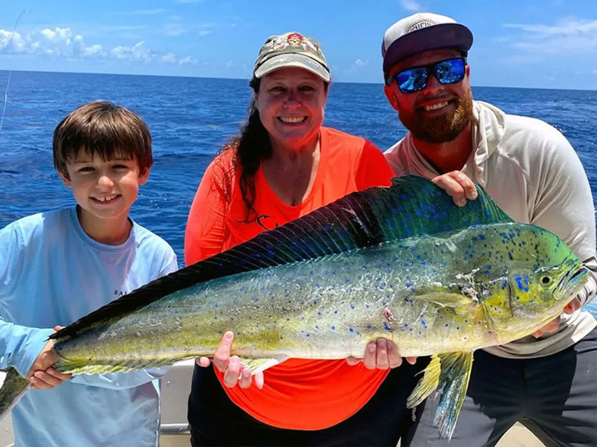
Mahi Mahi: MODERATE-GOOD — The 1 ft east swell at 3 seconds holds sargassum weedlines together. With north wind shifting to NE, look for convergence lines offshore. Run the 100-300 ft depth range off Alligator. Trolled ballyhoo behind a bird or daisy chain. Frigate birds are your best indicator — if you see them working, get there.
-
Blackfin Tuna: MODERATE — First light and dusk windows at the color change. The Stream edge off Alligator (6 NM) and Conch are the spots. Small jet-head jigs at 25-30 kt trolling speed or yo-zuri surface plugs. The north wind may put a slight ripple on the Stream edge that helps conceal the boat. Bite windows are tight — 7-8 AM and 6:30-7:30 PM.
-
Cero Mackerel: GOOD — Active on the reef crests and inside edges early before the wind builds. Light chrome jigs and gold hooks on 15 lb leader at 20-35 ft. Crocker, Davis, and Alligator shallows. The north wind ripple on the inside can actually help them feed more aggressively. Light-tackle fun on the incoming tide.
-
Tarpon: MODERATE — The negative low at 8:33 PM is only -0.2 ft — significantly weaker than recent days. Tarpon may not concentrate at the bridges like they did during the negative-low flushes last week. Moon at 87% is still bright enough for nighttime feeding. Channel 5 and Long Key bridges are the best bet. The bite window shifts later — 9 PM to midnight as the incoming builds toward the 12:40 AM high. Live mullet or crabs.
-
Amberjack: MODERATE — Deep shelf at Alligator and Tennessee (80-120 ft). The weaker current means AJs may sit deeper or be more scattered. Live pinfish on 60-80 lb leader. Tennessee is the best bet if you want to pull on something heavy. The lighter current takes some of the fight out of the equation — less current resistance means less fatigue on the angler.
-
Grouper: MODERATE — The improving visibility from the calm stretch may actually make grouper less active during the day. Target the deeper ledges at Conch and Tennessee (80-120 ft). Live bait tight to structure. The red grouper bite on sand patches adjacent to ledges is still worth prospecting. Early morning and late afternoon are best.
-
Sharks: MODERATE — The reduced tide swing has sharks more scattered. They’re not locked on a single chum slick like during the full-moon flushing. Standard advice: if a shark takes over your spot, slide 200-300 yards down the ledge.
Midweek Front Assessment
The 4:37 AM NWS synopsis is direct: “Guidance is pointing to this frontal boundary to scrape through Keys waters through the back half of the week resulting in a period or two of freshened northeast to easterly breeze.”
Tuesday, June 2 — TODAY
- Wind: SW→NW→N-NE 5-10 kts
- Seas: 1 ft or less
- Rating: 8/10 — The rotation is smooth, not abrupt. Still flat. Still fishable. The morning bite is the move.
Wednesday, June 3 — Front arrives
- Wind: NE 5-10, building to 10-15 by afternoon
- Seas: 1 ft building to 2 ft Hawk Channel, 2-3 ft Straits
- Threats: Showers and thunderstorms likely (60-70%)
- Rating: 5/10 — Fishable in the morning. Afternoon gets rough. The morning incoming (high at 12:35 PM) is the window.
Thursday, June 4
- Wind: NE-E 10-15 kts
- Seas: 1-2 ft Hawk Channel, 2-3 ft Straits
- Threats: Showers and thunderstorms likely
- Rating: 4/10 — Marginal for small boats in the afternoon. Hawk Channel is still fishable but expect a bumpy ride.
Friday, June 5
- Wind: E 10-15 kts
- Seas: 1-2 ft Hawk Channel, 2-3 ft Straits
- Threats: Chance of showers/storms
- Rating: 5/10 — Similar to Thursday but slightly more settled.
Saturday, June 6
- Wind: NE-E 5-10 kts
- Seas: 1-2 ft
- Threats: Slight chance
- Rating: 7/10 — Improving. The front passes and winds back off.
The key takeaway from the forecast update: Thursday’s Straits seas show 2-3 ft, not the 3-4 ft that was appearing in earlier model runs. The front may not have the punch initially feared. It does bring elevated rain chances (likely category — 60-70%) on Wednesday and Thursday, which will impact the afternoon bite more than the morning.
Overall Assessment
Rating: 8/10
The summary: A transition day. The wind rotates, the tide shrinks, but the seas stay flat. The approaching front Wednesday-Thursday changes the equation, but today and tomorrow morning are still prime windows.
What’s improved:
- The north wind direction opens up structure faces that have been calm for days
- Light chop on the inside can actually improve the bite by masking boat noise
- Fewer boats on a Tuesday post-holiday weekend
What’s different from yesterday:
- Wind rotates through the compass — SW→NW→NE over the course of the day
- Tide swing continues to moderate — negative low at 8:33 PM is just -0.2 ft
- The bite window shifts to the morning incoming (6:42 AM - 11:56 AM)
- Showers/thunderstorms chance increases (30-50% vs 20% Monday)
The game plan:
- 7-11 AM: Incoming toward the 11:56 AM high. The premium bite window. Cero on the shallow reef. Start the chum program early for yellowtail.
- 11:56 AM - 4 PM: Outgoing on the reef edge. Lighter sinkers, tighter chum. Yellowtail steady but not bailing.
- 4 PM - 8 PM: Late outgoing. The bite tapers. Check weedlines offshore if conditions hold.
- 8:33 PM onward: Weak negative low then incoming. Tarpon bite is possible but not guaranteed — the tide doesn’t flush hard enough to stack them up.
Captain’s advice: Today rewards the early riser. The morning incoming toward 11:56 AM high is the bite window — from 7 AM to noon, the water floods the reef and the fish feed. By 2 PM the outgoing has built but the current is light, and the afternoon seabreeze brings the chance of a shower.
Use today to load the box for tomorrow if the front kills the afternoon bite. If the Wednesday forecast holds, that morning incoming (toward 12:35 PM high) will be the last good window before the NE wind builds Thursday.
The negative low at 8:33 PM is barely negative — don’t plan your whole day around a tarpon evening session. If you get out there and it happens, great. If not, you had the premium incoming bite in the morning. Fish the flood.
Data sources: NOAA NDBC, NWS Key West Marine Forecast FZUS52 KKEY issued 4:37 AM EDT June 2, 2026, NOAA Tides & Currents station 8724580 (Key West), NOAA Tide Predictions station 8723214 (Virginia Key), seatemperature.org, NOS CO-OPS
Sunrise 6:32 AM EDT · Sunset 8:07 PM EDT · Moon: 87% illumination — Waning Gibbous (3 days after Full Moon)
🕐 Midday Addendum — 11:30 AM EDT / 15:30 UTC
NWS Update: FZUS52 KKEY issued 10:19 AM EDT
No significant changes from the morning forecast. Here’s what the midday update confirms:
What’s Holding
- Winds: This afternoon now shows variable near 5 knots (morning had N-NW 5-10). If anything, the wind is lighter than originally forecast through the afternoon. The transition to N-NE is more gradual — the variable/light pattern extends through this afternoon, not the northerly 5-10 kts the morning model pushed.
- Seas: 1 foot or less across all zones. Hawk Channel, Florida Bay, Bayside/Gulfside all smooth. No change from morning.
- Straits Wave Detail: East 1 ft at 3 seconds — unchanged. No new swell energy. No period change.
- Synopsis: Weak high pressure continues. Same frontal boundary timing — arrives Wednesday, scrapes through the back half of the week.
What’s Notable
- The wind is even lighter than expected. The 10:19 AM forecast dropped the N 5-10 kts and replaced it with “variable” — the weakest designation. That’s a meaningful downgrade from the morning outlook. If you’re on the water right now, you’re getting flat conditions with no real wind direction settling in yet.
- Storm timing consistent: Afternoon showers/thunderstorms remain a chance (30-50%), not likely (60-70%). The front’s instability arrives Wednesday, not today.
Practical Takeaway for the Afternoon
The morning forecast was right on everything except wind strength. The wind is coming in even lighter. That means:
-
The outgoing bite (12 PM - 5 PM) is better than morning-rated. With wind variable/light, the chum slick settles tighter to the boat and the yellowtail don’t have chop pushing them off structure. Stick with the 1-1.5 oz sinker recommendation — it’s working.
-
Offshore weedlines should still be intact. The east 1 ft swell at 3 seconds hasn’t changed — sargassum lines hold together. North wind pushing over the Stream edge creates convergence. If the morning charter has already hit the reef hard, a 2 PM run offshore for mahi is well worth it.
-
Tomorrow’s forecast unchanged: NE 5-10 kts Wednesday with showers likely. The front arrives on schedule. Today’s light wind is a bonus afternoon.
NOAA Buoy Ground Truth (PKYF1 — Peterson Key)
The 5:00 AM reading noted in the morning report (87.6°F, 36.58 psu) is the latest available midday data for Florida Bay. No afternoon buoy update to report yet — but with winds this light, water temps are likely holding or climbing slightly into the 88°F range.
Bottom line: The morning report stands. If anything, conditions are slightly better than advertised. Get out there.
Conditions data provided by FishIntel.ai — AI-powered fishing intelligence for the Florida Keys & beyond.