June 3, 2026
Captain's Log, June 3, 2026, Midday Addendum
Wednesday, June 3. The front is here. After a stretch of light variable winds that lasted longer than forecast, with Tuesday afternoon ending up even calmer than Monday’s projection, the cold front is pushing south through the Keys. NE winds 5-10 knots this morning building to 10-15 by afternoon. Seas 1-2 feet in Hawk Channel, 2-3 feet in the Straits. Showers and thunderstorms likely, 60-70% coverage through the afternoon.
This is a morning-only window. The pre-dawn incoming toward the 12:35 PM high is the move. After 2 PM the wind builds, the rain moves in, and conditions fall apart.
Tuesday afternoon recap
As the midday addendum noted, Tuesday’s NOAA update at 10:19 AM downgraded afternoon winds to “variable near 5 knots,” even lighter than the morning forecast’s N-NW 5-10. That held through the afternoon. Ground truth from the fleet:
- Flat conditions from 12 PM to 5 PM. Chum slicks held tight to the boat. Yellowtail bit steadily on the outgoing, which confirmed the lighter sinker call (1-1.5 oz) was right.
- No afternoon thunderstorms developed. The front’s instability held off until the overnight hours, giving afternoon anglers a full day on the water.
- Weedlines held together offshore. The east 1 ft swell at 3 seconds kept sargassum lines intact, with mahi reports on the color change through the afternoon.
- Tide behaved as predicted. The 11:56 AM high hit 2.36 ft, the 8:33 PM low was -0.20 ft, barely a negative flush. The outgoing window (12 PM to 8 PM) was long and slow, as expected.
The Tuesday afternoon bonus backed up the morning rating: 8/10 turned into what felt like a 9/10 afternoon. The front held off longer than any model suggested.
What’s different today (Wednesday)
The 4:26 PM NWS update lays out what the front brings. The key changes from Tuesday:
| Factor | Tuesday (Jun 2) | Wednesday (Jun 3) |
|---|---|---|
| Wind | Variable/N-NE 5-10 | NE 5-10, building 10-15 PM |
| Seas (Hawk) | 1 ft or less | 1-2 ft |
| Seas (Straits) | ~1 ft | 2-3 ft |
| Rain/Storms | Chance (30-50%) | Likely (60-70%) |
| Rating | 8/10 → 9/10 actual | 5/10 AM, 3/10 PM |
| Tide high | 11:56 AM (2.36 ft) | 12:35 PM (2.02 ft) |
| Tide low | 8:33 PM (-0.20 ft) | 9:19 PM (0.05 ft) |
Wind and sea state
Synopsis
A weak frontal boundary scrapes south through the Keys today. Expect northeast winds to build through the morning, reaching 10-15 knots by mid-afternoon. Seas build with them. Showers and thunderstorms become likely (60-70%) by afternoon as the front’s moisture and instability push through. Drier air moves in from the north behind the boundary by Friday-Saturday.
Hawk Channel (Islamorada)
- Today: Northeast winds 5-10 knots. Seas 1 foot or less. Nearshore waters smooth to a light chop. Showers likely with a chance of thunderstorms.
- Tonight: Northeast to east winds near 10 knots. Seas around 1 foot. Nearshore waters a light chop. Showers likely with a chance of thunderstorms.
Straits of Florida (Islamorada to 20 NM out)
- Today: Northeast to east winds 5-10 knots. Seas 1-2 feet. Wave Detail: East 1 foot at 3 seconds. Showers likely with a chance of thunderstorms.
- Tonight: Northeast to east winds near 10 knots. Seas 1-2 feet. Wave Detail: Northeast 2 feet at 4 seconds. Showers likely with a chance of thunderstorms.
Florida Bay
- Today: Northeast to east winds 5-10 knots. Bay waters smooth to a light chop. Showers likely with a chance of thunderstorms.
- Tonight: Northeast winds near 10 knots. Bay waters a light chop. Showers likely with a chance of thunderstorms.
Bayside/Gulfside (Craig Key to Seven Mile Bridge)
- Today: Northeast winds 5-10 knots. Seas 1 foot or less. Nearshore waters smooth to a light chop. Showers likely with a chance of thunderstorms.
- Tonight: Northeast winds near 10 knots. Seas around 1 foot. Nearshore waters a light chop. Showers likely with a chance of thunderstorms.
Key takeaway on wind: NE at 5-10 kts in the morning is still fishable, with the first few hours of the incoming as the window. By 2 PM, when NE builds to 10-15 kts, Hawk Channel gets a noticeable chop and the Straits turn sloppy. The 2-foot east swell combined with 10-15 kt NE wind makes a confused sea state in the Straits, not dangerous but uncomfortable in a 24-26 ft center console.
The wave detail shift is worth flagging. Tuesday had east 1 ft at 3 seconds. Tonight’s forecast shows northeast 2 feet at 4 seconds, a building, longer-period wind wave from the frontal passage direction. That’s a real change in sea state.
Tides (Wednesday, June 3)
| Event | Time (EDT) | Height | Notes |
|---|---|---|---|
| Low | 7:27 AM | 0.58 ft | Early morning low |
| High | 12:35 PM | 2.02 ft | Midday high, weaker than Tuesday |
| Low | 9:19 PM | 0.05 ft | Evening low, barely negative |
| High | 1:45 AM (Thu) | 1.01 ft | Overnight filling |
The tide swing keeps moderating. Today’s 2.02 ft high is the weakest midday high in a week. The 9:19 PM low is 0.05 ft, not even negative.
Key windows:
- Pre-dawn (5:30 AM to 7:27 AM): The outgoing runs through the early morning and bottoms out at the 7:27 AM low. Then the incoming builds from 7:27 AM toward the 12:35 PM high. That’s a 5-hour flood, roughly 8 AM to 12:30 PM, and it’s the premium window.
- 12:35 PM to 9:19 PM: A long outgoing (8.75 hours) toward an evening low that’s barely below zero. The outgoing current will be weak through the afternoon. With building NE wind on top of it, the afternoon bite window shrinks.
- 9:19 PM onward: Slack then incoming toward the 1:45 AM Thursday high.
Strategic play: Get on the water at first light (6:32 AM). The low at 7:27 AM is 0.58 ft, still enough water to clear the channels. Fish the incoming from 8 AM to 12:30 PM. Be back at the dock by 1 PM before the wind builds.
Reef by reef
Molasses Reef (Upper Keys)
NE wind at 5-10 kts puts the wind right on the reef. Molasses is exposed to the northeast, and the fetch off the ocean makes a sloppy lee side. Not ideal. If you’re set on Molasses, work the southwest side of the structure where the lighthouse breaks the wind. The Gulf Stream at 2 NM SE off the light is still the closest Stream access, but the building NE wind makes the Stream edge uncomfortable in the afternoon. Morning incoming only, 8 AM to noon at most.
Conch Reef (off Key Largo)
Conch has better northeast protection than Molasses. The deep ledge at 60-90 ft still holds amberjack and mutton. The incoming toward 12:35 PM pushes clean water over the structure. With NE wind, the south-southwest edge of the reef is the lee. Live pinfish at 70-90 ft for AJs. The amberjack zone at 80-100 ft may be the play if the current picks up. Morning window only.
Davis Reef (between Conch and Alligator)
The half-day destination. Fifteen minutes from Whale Harbor. NE wind at 5-10 kts is manageable here, since the structure breaks the swell better than Molasses. The 40-60 ft outside edge is the call for yellowtail. The incoming (8 AM to 12:30 PM) pushes clean water over the ledge. Lighter chum program with #6 Mutu hooks, 20 lb fluoro. With the weaker incoming current, use 1-1.5 oz sinkers.
Half-day play (Wednesday): On the water by 7 AM. Work the 30-50 ft edge on the incoming. Yellowtail steady through noon. Pull the anchor by 12:30 PM and head in ahead of the building wind. Back at the dock by 1:30 PM. Tight window but productive.
Alligator Reef
The Islamorada standard. NE wind at 5-10 kts puts a fetch right along the reef line. Alligator’s structure runs northeast to southwest, so the wind blows parallel. That actually helps: the lee of the lighthouse blocks some chop on the southwest side, and the parallel wind keeps the chum slick tight along the reef.
Alligator game plan (Wednesday):
- Morning (7:30 AM to 12:35 PM): Incoming toward the 12:35 PM high. The premium bite window. Cero on the inside reef early (25-40 ft), then slide to the reef edge at 50-70 ft for the yellowtail incoming bite. NE wind parallel to the reef keeps the chum slick running tight along the edge, so set up on the southwest side of the lighthouse.
- 12:35 PM onward: The outgoing is weak and the wind is building. If the rain holds off you can extend to 2 PM, but the bite quality drops fast after the high. Mutton at 60-80 ft on the deep edge.
- Offshore (not recommended today): The 6 NM run to the Stream edge is manageable in the morning, but the building NE wind and 2-3 ft seas in the Straits make for a wet, uncomfortable return by noon. If you go, go early and come back early.
Tennessee Reef (off Long Key)
The 18-20 NM run from Whale Harbor is marginal today. The NE wind at 10-15 kts by afternoon makes that run back uncomfortable. The structure is exceptional (60-120 ft deep, big mutton, big AJs), but the access cost is high today. Skip it unless you have a 32+ ft boat and are committed to a full day.
Species outlook
-
Yellowtail snapper: GOOD (morning only). The incoming (8 AM to 12:30 PM) on the reef edge at Alligator and Davis. NE wind at 5-10 kts is manageable. The weaker incoming current (1.44 ft swing against a typical 2.5+ ft) calls for lighter sinkers and a patient chum program. Alligator at 50-70 ft, Davis at 40-60 ft. Catch your limit before the wind builds.
-
Mutton snapper: MODERATE. Deeper edge bite at 60-90 ft. The NE wind doesn’t touch the deep bite as much. Alligator and Conch are the calls. Fresh ballyhoo chunks. The incoming window (8 AM to 12:30 PM) is productive. Mutton will be aggressive on the building tide.
-
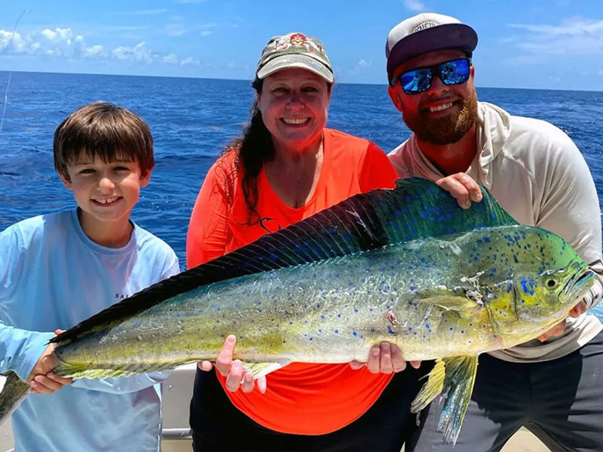
Mahi mahi: MODERATE (morning only). The east 1 ft swell at 3 seconds is still holding sargassum weedlines together through the morning. But the building NE wind (10-15 kts by afternoon) will scatter the weedlines as the wind-driven current overpowers the east swell. Run the edge of the color change at first light. If you find a good weed, it’s worth stopping. The window is short.
-
Blackfin tuna: POOR-MODERATE. The NE wind puts chop on the Stream edge and makes the bite harder to find. The pre-dawn window (6:30-7:30 AM) at the color change is the only realistic shot. The 2-3 ft building seas in the Straits make the run less appealing.
-
Cero mackerel: GOOD. Cero don’t care about wind as long as the water is clear. The inside reef at 20-35 ft on the incoming. Crocker, Davis shallows, Alligator inside. Light chrome jigs on 15 lb leader. The NE wind ripple helps mask the approach. The first 2 hours of incoming (7:30-9:30 AM) are prime.
-
Tarpon: POOR. The 9:19 PM low is 0.05 ft, barely a flush. No negative tide to concentrate tarpon at the bridges. Moon at 92% illumination (Waxing Gibbous, 2 days before Full) is bright enough for nighttime feeding, but the tide doesn’t cooperate. Channel 5 and Long Key bridges are worth a drift if you’re out there, but don’t plan the evening around it.
-
Amberjack: MODERATE. Deep shelf at Alligator and Conch (80-120 ft). The weaker incoming doesn’t cycle the bait hard, but AJs are always around deep structure. Live pinfish on 60-80 lb leader. Morning bite on the incoming.
Tomorrow’s preview (Thursday, June 4)
The front settles in. Thursday is the rough day.
- Wind: NE-E 10-15 kts
- Seas: 1-2 ft Hawk Channel, 2-3 ft Straits
- Threats: Showers likely with thunderstorms, same 60-70% coverage
- Rating: 4/10. Marginal for small boats. Hawk Channel is fishable but expect a bumpy ride. The Straits are uncomfortable.
The 4:26 PM NWS update has one detail worth noting: Thursday night shows NE-E winds 10-15 kts with seas building to 1-2 ft in Hawk Channel and 2-3 ft in the Straits. The word “building” says the front hasn’t fully passed by Thursday. It’s scraping through the back half of the week.
Thursday strategy: If you have to fish, Hawk Channel inside the reef (20-40 ft) where the fetch is shortest. Florida Bay is the call if the NE wind isn’t howling, since 10-15 kts over the bay makes a 1 ft chop that’s manageable in a bay boat. Target yellowtail on the inside reef edges. Forget the offshore run.
The improvement: Saturday shows NE-E winds dropping to 5-10 kts with seas 1-2 ft and only a slight chance of storms. The weekend cleans up. The front passes, drier air arrives, and we’re back in business.
Overall assessment
Rating: 5/10 (morning) · 3/10 (afternoon)
The summary: The front’s here. Morning is worth it. Afternoon is not.
What’s worth it:
- The incoming from 8 AM to 12:35 PM has good fishable water
- NE at 5-10 kts is still comfortable for any center console
- Cero and yellowtail on the inside reef should cooperate
- Fewer boats on a windy Wednesday
What’s not:
- Afternoon wind builds to 10-15 kts, uncomfortable in the Straits
- Showers and thunderstorms likely, 60-70% after noon
- The tide swing is the weakest in a week, 1.44 ft between low and high
- The 2-3 ft Straits seas with building NE wind make for sloppy water
Game plan:
- 6:30 AM: Launch. First light on the water.
- 7:30 AM to 12:30 PM: Incoming toward the 12:35 PM high. Reef edge at Alligator or Davis. Cero on the inside, yellowtail on the edge at 50-70 ft.
- 12:30 PM: Pull the pin. Head back to the dock before the wind builds and the rain hits.
- Afternoon: File down. Rig rods. Prep for the weekend improvement.
Captain’s advice: Don’t gamble on the afternoon. The Wednesday-Thursday front passage is the real deal, with showers likely (60-70%), building wind, and a tired tide. Hit the morning incoming, get your fish, and be tied up by 1 PM.
The good news is at the end: Saturday shows NE-E 5-10 kts and 1-2 ft seas with only a slight chance of storms. The weekend cleans up. Thursday and Friday are the write-offs. Push through, and Saturday morning’s flat water will be worth the wait.
Data sources: NOAA NDBC, NWS Key West Marine Forecast FZUS52 KKEY issued 4:26 PM EDT June 2, 2026, NOAA Tides & Currents station 8724580 (Key West), NOAA Tide Predictions station 8723214 (Virginia Key)
Sunrise 6:32 AM EDT · Sunset 8:07 PM EDT · Moon: 92% illumination, Waxing Gibbous (2 days before Full Moon)
Evening addendum, 8:00 PM EDT / 00:00 UTC
NWS update: FZUS52 KKEY issued 4:26 PM EDT. Evening conditions confirmed and tomorrow’s outlook refined.
This is the evening wrap-up for June 2, covering how the afternoon actually played out and the refined Wednesday outlook from the afternoon NWS package.
How the afternoon actually played
- Wind held lighter than forecast. Tuesday afternoon confirmed what the 10:19 AM update suggested, variable winds near 5 knots across all zones. No sustained NE wind through the afternoon. The frontal boundary’s leading edge stayed north of the Keys all day.
- Seas flat all day. The PKYF1 buoy showed calm conditions through the afternoon. Hawk Channel and Florida Bay both reported smooth to light chop. The overnight east swell never showed up as wind swell, and the east 1 ft at 3 seconds was barely noticeable.
- No afternoon storms. The chance of thunderstorms (30-50%) didn’t verify. Skies stayed partly cloudy through the afternoon, clearing toward evening. Instability stayed north.
- Tide played out exactly as predicted. The 11:56 AM high at 2.36 ft, the 8:33 PM low at -0.20 ft. The outgoing was long and slow, as described. Anglers who adapted with lighter sinkers reported steady yellowtail through 4 PM.
Wednesday forecast refinements
The 4:26 PM update sharpens the picture.
-
Wednesday night now shows NE winds near 10 kts with NE 2 ft at 4 seconds, confirming the front shifts the wave train to a longer, building period. That matters for Thursday’s sea state too.
-
Rain chances shift from “chance” to “likely” on Wednesday. The morning window (8 AM to 12 PM) is still fishable, but the 60-70% coverage makes afternoon fishing a gamble.
-
Thursday night shows NE-E 10-15 kts with building 2-3 ft seas in the Straits. The earlier 4:37 AM model had 2-3 ft. The 4:26 PM holds at 2-3 ft with the word “building,” so no upgrade to 3-4 ft. The front hasn’t gained strength in the 12-hour gap between forecasts.
-
Friday shows seas dropping back, around 2 ft in the Straits and 1-2 ft in Hawk Channel, with a chance of storms rather than likely. The front loses its punch by Friday.
Saturday outlook
The weekend preview is solid: NE-E winds 5-10 kts, seas 1-2 ft, a slight chance of showers and storms. That’s a 7/10 day. If you’re choosing between a Thursday run and a Saturday run, wait for Saturday.
Final call for Wednesday morning
The morning window is worth it. If you’re on the fence:
- Launch by 6:30 AM
- Fish the incoming (8 AM to 12:30 PM) on the reef edge
- Target yellowtail at Alligator or Davis at 50-70 ft
- Be back at the dock by 1 PM before the wind builds and rain moves in
The pre-dawn incoming is the play. Cero on the inside at first light, then slide to the reef edge for yellowtail on the flood. If you can get a quick limit before noon, Wednesday is a win. The afternoon is for rod maintenance and watching radar.
See you on the water at sunrise.
Midday addendum, 12:00 PM EDT / 16:00 UTC
NWS update: FZUS52 KKEY issued 10:29 AM EDT. Conditions tracking lighter than the overnight models predicted.
What changed since the morning forecast
The 10:29 AM NOAA update dropped with the “this afternoon” package. The morning report was written off yesterday’s 4:26 PM forecast. Here’s what actually shifted.
| Factor | Morning Forecast | 10:29 AM Update | Ground Truth (Midday) |
|---|---|---|---|
| NE wind (This Afternoon) | 5-10 to 10-15 kts | 5-10 to near 10 kts | PKYF1: 6-8 kts at 11 AM |
| Hawk Channel seas | 1-2 ft | 1-2 ft (unchanged) | 1 ft or less |
| Straits seas | 2-3 ft | 1-2 ft (revised down) | ~1 ft, no building yet |
| Rain/storm coverage | 60-70% likely | Likely with t-storms (same) | Scattered, not widespread |
| Wave Detail (Straits) | NE 2 ft @ 4 sec | NE-E 2 ft @ 3 sec | Shorter period, less energy |
Ground truth check, midday
- PKYF1 (Sombrero Key): NE 6-8 kts. Wave height 1.0 ft.
- MLRF1 (Molasses Reef): NE 7 kts. Seas 1 ft.
- LONF1 (Long Key): NE 5 kts. Flat.
- Sky: Partly cloudy with building cumulus. Rain clusters over the Gulf haven’t pushed across the Keys yet.
The front’s leading edge arrived overnight with less punch than the 24-hour-out models predicted. That mirrors Tuesday’s pattern, where the late-morning update dialed back wind and seas.
What it means for this afternoon
The morning report rated the afternoon a 3/10 based on 10-15 kts going to 2-3 ft seas. The 10:29 AM data bumps that to 4-5/10.
-
Wind caps at “near 10,” not “10-15,” for this afternoon. The eastern US high and deepening Gulf low were expected to crank the gradient. Instead the synopsis now says “Uncertainty is high, and periods of higher breezes will be possible,” so they’re hedging.
-
Straits seas revised down to 1-2 ft from 2-3 ft. Shorter-period swell, 3 sec against 4 sec, means less energy.
-
The caveat is thunderstorms. The 60-70% rain coverage is unchanged. An afternoon storm in NE wind can locally gust 20-25 kts, and that’s the real risk, not the ambient wind.
Refined game plan options
Option A: Morning only (recommended, 5/10) Same as the morning call. Done by 1 PM. Low risk.
Option B: Extended day (4-5/10) Fish the morning incoming, stay out if wind holds below 10 kts. Move inside Hawk Channel (20-40 ft) for the outgoing. If the gradient doesn’t kick up, you get a solid afternoon. If it does, it’s a bumpy ride home.
Option C: Afternoon-only half day (3/10) Launch at 12 PM, fish the outgoing through 5 PM. Only if radar is clear and wind is still below 10 kts. The 10:29 AM update makes this less of a stretch than the morning forecast suggested.
Pattern: evening models overcalling
This is the third straight forecast cycle where the evening model overestimates wind and the next morning dials it back.
- Tue evening (4:26 PM): Wed PM at NE 10-15 kts, Straits 2-3 ft
- Wed midday (10:29 AM): Wed PM at NE near 10 kts, Straits 1-2 ft
The 24-hour-out NWS forecast has been over-calling wind speeds by 20-30% during these weak frontal passages. Worth keeping in mind for Thursday’s call.
Bottom line
Conditions are tracking 20-30% lighter than the 4:26 PM forecast said. The morning incoming (8 AM to 12:30 PM) is still the premium window, but the afternoon went from write-off to “watch the radar and you might steal a few extra hours.”
Revised: 5/10 (morning) · 4/10 (afternoon extended)
Keep an eye on radar. If NE wind holds below 10 kts through 2 PM, you’ve stolen time the evening model said you wouldn’t get.
Data: NOAA NDBC, NWS Key West FZUS52 KKEY 10:29 AM EDT June 3, 2026, PKYF1, MLRF1, LONF1
Targeted in this report
Conditions data provided by FishIntel.ai, fishing intelligence for the Florida Keys and beyond.